Forecast pattern shift signals widespread Oklahoma rainfall next week, with warming, fire concerns, and severe-storm potential
Changing setup could bring several rounds of rain across the state
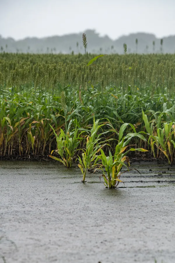
Oklahoma is heading into the final weekend of February with springlike warmth and pockets of elevated fire danger, but forecasts point to a more unsettled pattern developing next week that could deliver widespread rainfall. The signal aligns with broader Southern Plains outlooks indicating a turn toward warmer and potentially wetter conditions in early March, with the strongest short-term improvement expected across central and eastern Oklahoma.
In the near term, temperatures are projected to run well above seasonal averages through Saturday, with many locations climbing into the 70s and some approaching 80. Forecasts also indicate a risk for grassfire spread on Friday as dry air overlaps with warmth, although wind strength will be a key variable in how quickly any fires could grow.
When rain could arrive and what it may look like
Forecast timelines indicate the first meaningful chance of showers arrives late Saturday night into Sunday, coinciding with a cold front that is expected to bring a noticeable cool-down. After that initial push, rain chances remain in the forecast into early next week, with day-to-day fluctuations in coverage and intensity. This type of multi-day setup can produce uneven totals, with some communities receiving repeated showers while others see lighter, intermittent rainfall.
Late Saturday night into Sunday: Increasing odds for showers as cooler air arrives.
Monday: Rain chances may briefly dip, depending on how quickly the initial system exits.
Tuesday and beyond: Another increase in rain potential is possible as additional disturbances move through the Southern Plains.
Severe weather is a conditional risk, not a certainty
Alongside the rain potential, forecasters are monitoring the possibility of thunderstorms later next week, particularly across central and western Oklahoma. At this range, details such as storm timing, instability, and wind shear remain uncertain. The same large-scale ingredients that can support widespread beneficial rain can also, under the right conditions, concentrate heavier downpours and stronger storms into narrower corridors.
Why the shift matters: drought and short-term impacts
A wetter pattern would be especially significant after a dry stretch that has expanded short-term dryness and drought concerns across parts of the region. Federal drought outlooks indicate that central and eastern Oklahoma could see at least short-term drought improvement if the wetter signal verifies in early March, while longer-range seasonal outlooks still suggest drought risk can persist in the western High Plains, including the Panhandles.
Rain chances are expected to increase next week, but the most impactful outcomes will depend on where repeated rounds set up and how much moisture each system can produce.
Forecasters emphasize that confidence typically increases as individual storm systems come into range, particularly for rainfall totals and any severe-weather window.
Greater Oklahoma City Chamber weighs State Question 843 proposal to phase out homestead property taxes statewide
Oklahoma victim service providers brace for reduced VOCA aid as federal Crime Victims Fund contracts

Oklahoma City Boards Tackle MAPS 4 Progress and Zoning Adjustments Today