Icy Roads and Arctic Chills: Oklahoma City Braces for a Bitter Thursday Front
A Frigid Start with Patchy Freezing Fog
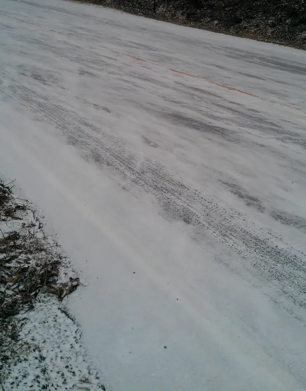
Oklahoma City residents are waking up to a biting chill this Thursday, January 29, 2026. Following the significant winter weather events of the past week, the National Weather Service has issued a heads-up for patchy freezing fog during the early morning hours. With humidity levels peaking near 93%, visibility may be reduced across central Oklahoma, particularly near bridges and overpasses. The mercury began the day in the mid-20s, and as moisture interacts with the cold pavement, the risk of black ice remains a primary concern for the morning commute. Road crews continue to monitor areas where previous snowmelt may have refrozen overnight, creating treacherous slick spots on residential streets and sidewalks.
Afternoon: Frontal Passage and Northerly Winds
As the morning fog lifts, a surface low-pressure system is expected to track across northwest Oklahoma, pushing a secondary cold front through the metro area. While no new precipitation is forecasted with this specific frontal passage, it will usher in a fresh layer of low cloud cover and a distinct shift in wind direction. Northerly winds will pick up speed between 10 and 15 mph, with occasional gusts reaching up to 20 mph. These winds will keep afternoon high temperatures well below seasonal averages, likely peaking between 34°F and 38°F. Despite the presence of some sun during the midday hours, the wind chill will make it feel significantly colder, often dipping into the low 20s.
Evening: Temperatures Plummet Toward the Teens
As the sun sets, the cloud cover is expected to gradually decrease, but the clearing skies will only accelerate the drop in temperature. By late evening, Oklahoma City will see the thermometer fall into the low 20s, eventually bottoming out near a low of 19°F overnight. The northerly breeze will persist, maintaining a steady flow of Arctic air into the region. This serves as a precursor to a much colder weekend ahead, as another Arctic high-pressure system begins to build across the northern plains. Residents should prepare for a significant temperature free-fall heading into Friday.
Safety Reminders and Travel Warnings
Given the current conditions, local authorities and weather experts advise the following precautions for the remainder of the day:
- Watch for Black Ice: Even if roads appear dry, shaded areas and bridges may still hold thin layers of ice from recent snowmelt refreezing.
- Check Your Vehicle: Ensure tires are properly inflated and batteries are in good condition, as the sustained cold can significantly impact vehicle performance.
- Protect the Vulnerable: Remember the four P's: People, Pets, Pipes, and Plants. Ensure outdoor animals have adequate shelter and that interior pipes are protected from the coming deep freeze.
- Dress in Layers: With wind chills forecasted to remain in the single digits and teens throughout the night, multiple layers of clothing are essential for anyone spending time outdoors.