Severe weather outbreak possible Friday across the Plains, with tornadoes, hail, and damaging winds
What forecasters are watching for Friday
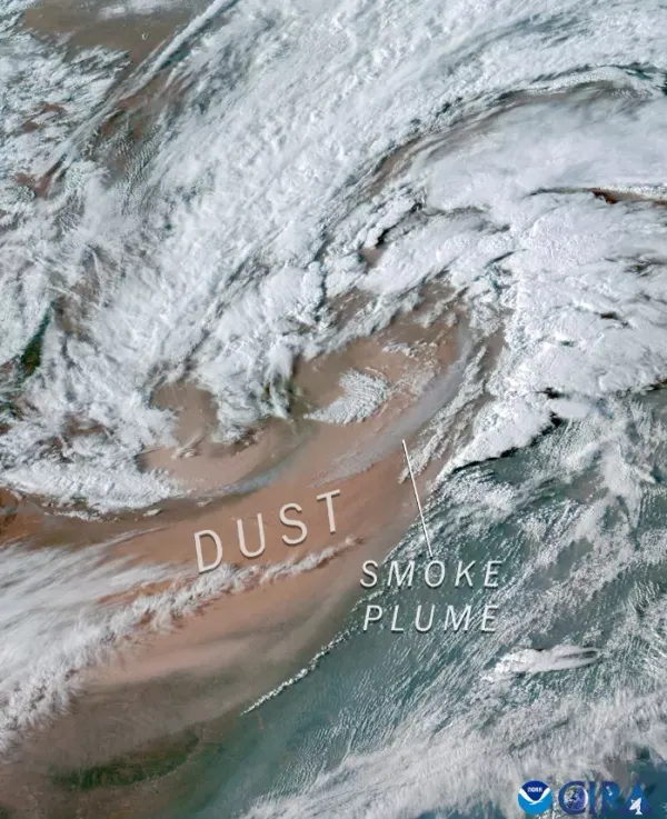
A potentially significant round of severe weather is expected to develop across parts of the Plains on Friday, March 6, 2026, as a storm system moves out of the Rockies and into a warm, moisture-rich air mass. Forecast guidance indicates conditions may support organized thunderstorms capable of producing large hail, damaging straight-line winds and tornadoes, including the possibility of strong tornadoes in the most favorable environment.
The threat is part of a multi-day pattern that has already produced severe thunderstorms in portions of the southern and central Plains and is expected to continue into the weekend, with additional rounds of thunderstorms possible farther east.
Areas most likely to see severe storms
Current outlooks place the greatest concern from Texas northward into Oklahoma, Kansas and Missouri, with the broader risk extending into adjacent parts of the central United States. The corridor includes major population centers in and near the region, including Tulsa and the Kansas City metro area.
Tornado risk: Highest where discrete supercell thunderstorms can develop ahead of the main line of storms, typically near the warm front or dryline.
Large hail risk: Likely with early, more isolated storms where strong updrafts can form in unstable air.
Damaging wind risk: Expected to increase if storms consolidate into a fast-moving squall line during the afternoon and evening.
Timing: from Thursday night through Friday evening
Severe thunderstorms may begin as early as Thursday evening, March 5, particularly across parts of the Texas Panhandle and western Oklahoma, before the primary outbreak potential increases on Friday. The most intense window for widespread severe weather is expected Friday afternoon into Friday night as the storm system strengthens and a cold front advances east.
Forecast uncertainty remains on storm mode and exact placement of key boundaries. Small shifts in the track of the surface low, the position of the warm front, or the timing of the strongest upper-level energy can change where the greatest tornado and hail risks set up.
Why this setup can produce multiple hazards
Severe-weather outbreaks in the Plains typically require a combination of ingredients: strong wind shear to organize storms, increasing instability as warm air rises, and sufficient moisture. Forecasters expect these ingredients to overlap on Friday across a broad area, raising the potential for supercells and, later, a more extensive line of storms.
Residents should plan for rapid changes in conditions, including storms that intensify quickly and hazards that vary by location and time of day.
What residents can do ahead of Friday
Review where to take shelter, especially if you live in a mobile home or a structure without a basement or interior safe room.
Ensure multiple ways to receive warnings overnight, including weather alerts that can wake you.
Secure outdoor items that can become windborne debris and plan for possible power outages.
Additional forecast updates are expected as new data refine storm timing and the highest-risk corridor.

Trump’s DHS pick Markwayne Mullin triggers rapid GOP maneuvering for Oklahoma’s next U.S. senator
Oklahoma pulls away from Florida 82-64 with decisive third quarter in SEC Tournament second round

Trump selects Oklahoma Sen. Markwayne Mullin for Homeland Security secretary role as Kristi Noem exits