Three new mobile radars unveiled in Norman as Oklahoma enters peak spring severe weather months
New field radar platforms added to Oklahoma’s storm research toolkit
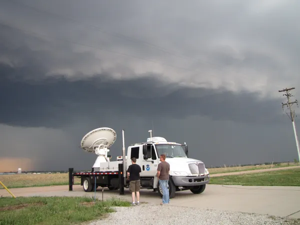
Three new mobile radar units were unveiled in Norman on March 30, 2026, expanding the ability of researchers to observe severe storms at close range as Oklahoma enters its most active months for tornadoes, large hail, and flash flooding. The systems are designed for deployment during severe weather events and for targeted studies of storm structure, intensification, and hazards that can change rapidly over minutes.
Mobile radars differ from fixed weather radars by allowing scientists to position sensors where storms are expected to evolve, rather than relying only on coverage from permanent sites. This approach is used to capture fine-scale features associated with rotating updrafts, damaging winds, hail formation, and rapidly shifting precipitation cores—details that can be difficult to resolve when storms are far from a stationary radar.
What mobile radars add beyond the standard network
Oklahoma and the broader central U.S. are monitored by the national weather radar network, which has recently completed a major service-life extension effort intended to keep those systems operational longer. While that network provides broad regional coverage and is central to routine forecasting and warning operations, mobile radars are used to collect research-grade measurements closer to storms and, in many cases, to scan more quickly or with different strategies than fixed radars typically employ.
Rapid updates matter because key storm processes—such as the development of rotation near the ground or sudden surges in wind—can occur on short timescales. Mobile platforms also enable coordinated field campaigns that combine radar data with other observations, including surface instruments, lightning mapping, and visual documentation.
How the new systems fit into ongoing Oklahoma radar development
Norman is a long-established hub for severe storm radar research. Recent work in Oklahoma has included mobile rapid-scanning radars and the development of phased-array approaches aimed at improving the speed and flexibility of storm sampling. In parallel, teams have pursued research that links radar signatures to lightning behavior and storm electrification—an area intended to deepen understanding of thunderstorm hazards that affect power systems, infrastructure, and public safety decisions.
- Mobile platforms can be placed to reduce blind spots created by distance, terrain, and beam height.
- Rapid scanning can better track evolving storm-scale features that emerge and dissipate quickly.
- Field measurements can be paired with multi-sensor systems that merge data from radar, lightning, satellite, and models.
In severe weather research, new observing systems are evaluated by how well they can document fast-changing storm processes, how reliably they can be deployed, and how effectively their data can be integrated with other sensors for analysis and, eventually, improved warning methods.
What happens next
The new mobile radars are expected to be used in upcoming deployments during the 2026 severe weather season, with an emphasis on collecting datasets that can be analyzed after events to refine understanding of storm hazards. In research settings, those findings can inform future scanning strategies, data quality controls, and methods used to interpret radar signals tied to tornado potential, hail growth, and extreme rainfall rates.
As with other research-grade observing systems, the immediate outcome is expected to be enhanced measurement capability in the field, with longer-term work focused on translating improved storm observations into advances that can support forecast and warning improvements.